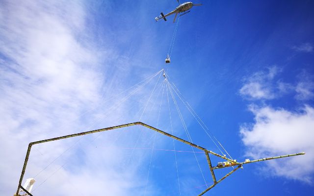
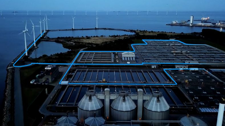
Helicopter survey will provide 3D image of salinisation and subsurface
Where can fresh or saline groundwater be found? At what depth? And where are there clay layers protecting the groundwater beneath? All useful information for provinces, water managers, drinking water companies, farmers, and nature managers. To help visualise this, a helicopter will be taking measurements from August this year until February next year in the southern, western, and northern Netherlands.
The helicopter measurements will be carried out as part of the FRESHEM-NL project, as part of which research institutes TNO Geological Survey of the Netherlands (TNO GDN) and Deltares work closely with 7 provinces, 7 water boards, and 5 water companies. The Dutch government will contribute funding from the Freshwater Delta Programme, which was set up to make the Netherlands more resilient to freshwater shortages.
'The results provide farmers, water and nature managers with more insight for sustainable and responsible water management.'
3D images up to 200 metres deep
The measurements will be taken with a measuring instrument suspended under a helicopter. The results will be used to create a three-dimensional image of the subsurface up to 200 metres deep. This will give researchers insight into the salinity of groundwater at different depths, and the location and thickness of clay layers.
The survey will be conducted in parts of North Brabant, Zeeland, South Holland, North Holland, Friesland, Groningen, and Drenthe. ‘The results are important for farmers, water and nature managers, and others. They’ll give us more insight into how we can deal with water in a sustainable and responsible way,’ says Jan Gunnink of TNO GDN.
‘By using helicopters, we can map large areas from Zeeland in the south to Groningen in the north, and parties will be able to use the project results for years to come,’ says Geert-Jan Nijsten of Deltares. The results of the survey will be made available to the public.
Treasure trove of information on freshwater and salinisation
Climate change is affecting the availability of freshwater, while we are also using up more and more of it. Because of its location by the sea, some of the groundwater in the Netherlands is saline.
The rising sea level is slowly making groundwater in coastal areas saltier, and makes saline groundwater flow in even under deep polders. This salinisation is harmful to agriculture and nature. ‘This makes it crucial for us to understand the salinity of groundwater,’ argues Jan Gunnink.
Geert-Jan Nijsten: ‘It’s also important to understand where clay layers are located. These protect the groundwater beneath them from pollution from above. Knowledge about clay layers is also needed to better understand groundwater flow and, in turn, the potential impacts of climate change and interventions into the water system.
To minimise the damage caused by salinisation to nature, agriculture, and businesses and ensure that sufficient drinking water is available in the long run, we need to get a good picture of the subsurface and groundwater. With the treasure trove of information that will come out of the FRESHEM project, we’ll make a key contribution to that.’
Helicopter flights
The helicopter used to take measurements will fly at a height of about 80 metres at a speed of 60 to 80 kilometres per hour. It will only fly in the daytime, and the strict rules on low flying by helicopter will of course be adhered to. There will be no flying during the breeding season, and special rules are in place for flying over nature reserves. Local residents will be informed about the exact schedule before the flights start from August.
The results are expected in the second quarter of 2027. They will then be made available via the FRESHEM-NL website.
Contact us
-
Maayke Koevoets
Functie:Project Manager Geological Survey of the Netherlands-
Standplaats:Utrecht - Princetonlaan
-
Email:Email Maayke
-
Get inspired
TNO and partners launch project to accelerate longduration energy storage in the Dutch energy system
Critical raw materials
CRM materials and processes
TNO–SodM–NIOZ: ‘Methane emissions in the North Sea often linked to shallow natural gas’

Heat