TNO investigates underground infrastructure for Einstein Telescope
The planned Einstein Telescope will be a highly sophisticated underground observatory capable of capturing gravitational waves from space so as to gain new insights into the universe. Because of the location and depth of this research centre, the Geological Survey of the Netherlands (part of TNO) is investigating the suitability of the subsurface there. For the investigation, TNO is collaborating with the Dutch National Institute for Subatomic Physics (Nikhef).
Major significance for international physics and astronomy
Gravitational waves contain information about the most extreme events in the universe, from the nature of black holes and neutron stars to the first moments after the Big Bang.
The underground Einstein Telescope will enable scientists to measure gravitational waves more precisely than ever before. This makes it highly significant for international physics and astronomy, and a driver of innovation for society.
Suitable location
The border region where the Netherlands, Belgium, and Germany meet – the Meuse-Rhine Euroregion – is an ideal location for the Einstein Telescope because of its tranquillity and stable soil, and its concentration of knowledge institutions and high-tech companies.
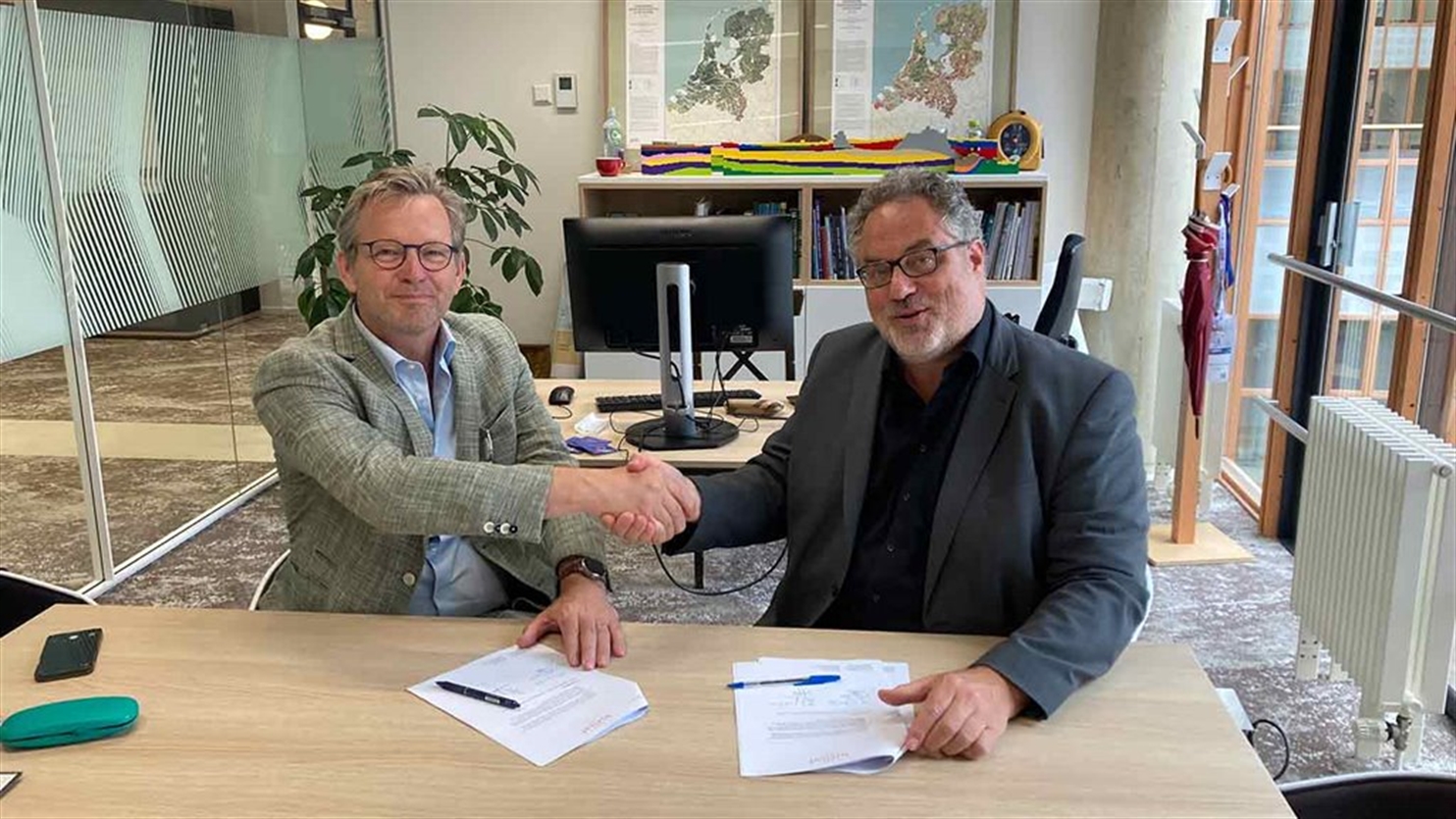
As regards siting the observatory, TNO will contribute to the feasibility study of the suitability of the subsurface. A cooperation agreement was recently signed for this purpose with Nikhef. Nikhef is the scientific partner in the project office that will explore the feasibility of siting the Einstein Telescope in the Meuse-Rhine Euroregion over the next few years.
Nikhef director Stan Bentvelsen explains: "For such a large and complex challenge as working on the Einstein Telescope, it's vital to have the support of sound partners. We have the expertise in house, but it's always wise to have another expert watch along with you, advise you, and weigh up the results. We're delighted that a leading institute like TNO is going to do that for us."
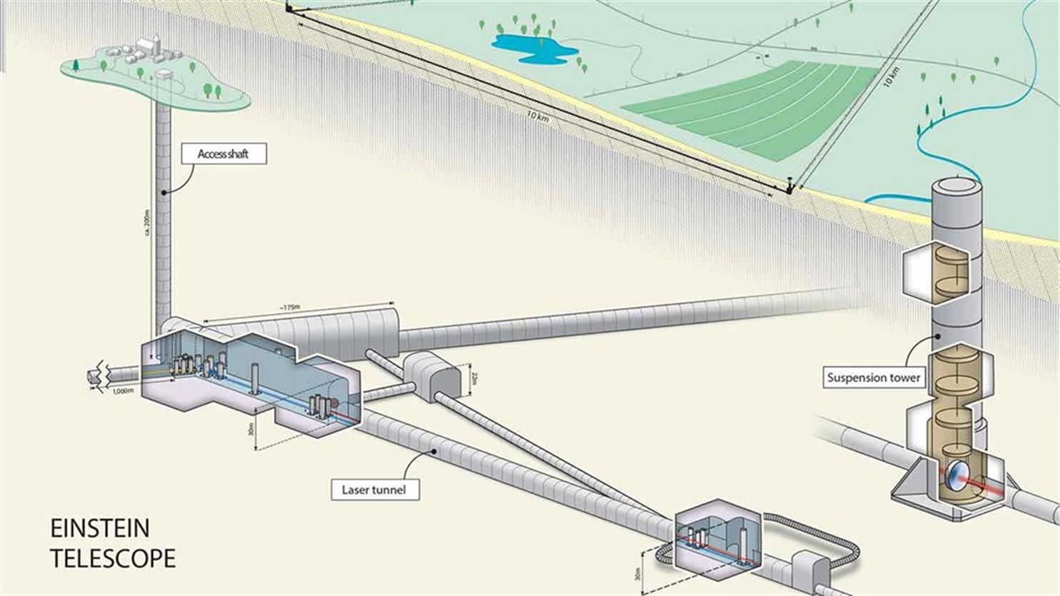
200 to 300 metres below the surface
Apart from the new technologies involved, the Einstein Telescope's unprecedented accuracy depends on it being installed at a depth of 200 to 300 metres below the surface, far away from surface vibrations and other unwelcome disturbances.
The underground infrastructure alone makes this a unique project, involving construction of three 10 km tunnels forming an equilateral triangle with vertical shafts at the vertices; this structure needs to be designed in close collaboration between tunnelling engineers and geoscientists.
Michiel van der Meulen, chief geologist for the Geological Survey of the Netherlands says: "We are proud to contribute to the study and look forward to working together. It's a fantastic prospect: studying the universe from underground."
More information about the Einstein Telescope
Contact us
-

Michiel van der Meulen
Functie:Chief Geologist Geological Survey of the Netherlands-
Standplaats:Utrecht - Princetonlaan
-
Email:Email Michiel
-
Get inspired
Li-ion battery recycling in the Netherlands: Big ambitions, small volumes
Why groundwater needs stewardship
Oil and gas in transition

TNO and partners launch project to accelerate longduration energy storage in the Dutch energy system
CRM materials and processes