Data-driven approach increases road maintenance efficiency and sustainability
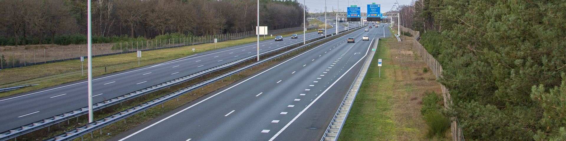
With responsibility for a densely branched road network, Rijkswaterstaat’s maintenance task is a challenging one. The detailed mapping of the load-bearing capacity of all national roads will enable more proactive, efficient, and sustainable maintenance. This data-driven approach to the road network is one of the projects within the Agreements Framework of the Ministry of Infrastructure and Water Management (IenW), Rijkswaterstaat, and TNO. The strategic partnership aims to encourage the exchange of knowledge regarding circularity and the environment, smart and sustainable mobility, infrastructure, and maritime offshore.
When they think of asphalt, most people initially only consider the visible top layer, which in our country consists of about 90% ‘ZOAB’ (highly open-graded asphalt concrete). Maintenance planning of this overlay is already well organised. But the underlying layers (between 25 and 50 centimetres thick) are also gradually degrading. ‘The load-bearing capacity of those deeper layers is slowly decreasing due to continuous traffic loads’, explains Greet Leegwater, road materials researcher at TNO. ‘Traffic, especially heavy lorry traffic, creates tensile stresses in the bottom parts of the structure. Over time, the fatigued structure collapses. Repairs after major damage are often many times more costly than relatively minor preventive interventions, so timely detection is incredibly important.’

‘What this approach adds is that we can now look up to 30 years ahead for degradation and expected maintenance.’
‘Looking ahead up to 30 years’
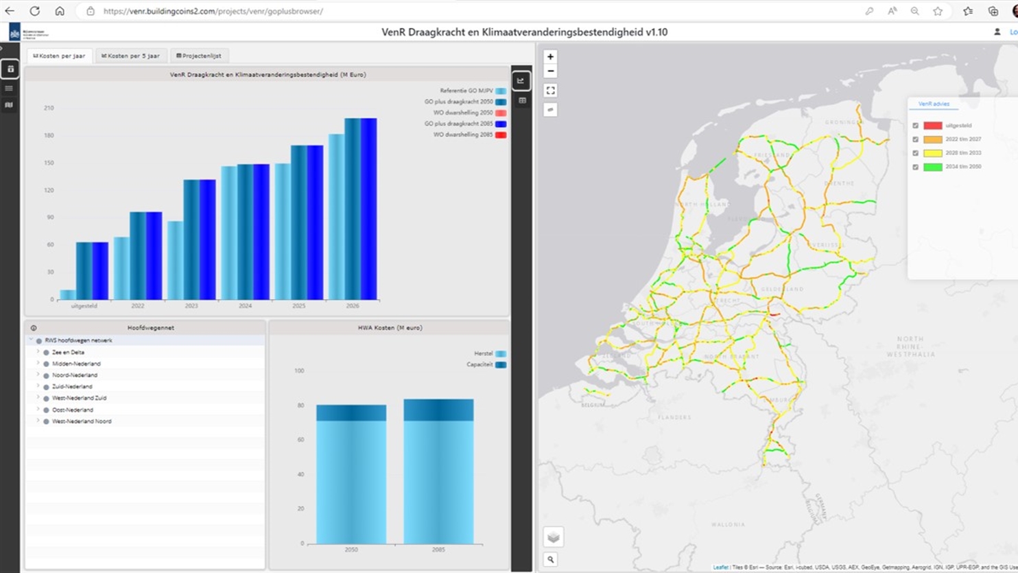
A residual lifetime model for the load-bearing capacity of the approximately 5,500 kilometres of national roads did not yet exist. ‘What the combination of this new data-driven approach and the model add is that we can now look up to 30 years ahead for degradation and expected maintenance for every 100 metres of road’, explains Leegwater. ‘This insight can then be used to accurately plan maintenance and its financing.’
It comes from a combination of different types of information. ‘We wondered, “What if you measure the load-bearing capacity of the deeper asphalt layers and used a damage model to combine that data with future expected traffic load?” On many of our roads, loops already record vehicle numbers and lengths. This information can be used to estimate the number of passenger and freight vehicles on a route. On top of this, the researchers use so-called ‘weigh-in-motion’ (WIM) data to calculate the traffic’s weight. Combining weighing-point data with loop data produces a fairly accurate load estimate. Subsequently, future traffic growth – especially freight traffic – is considered.
Two years of measurements
The load on the asphalt can be accurately estimated and is available. But how do you measure the condition of the asphalt layers? ‘This requires data on their load-bearing capacity’, outlines Leegwater. Previous state surveys had already mapped about a third of the roads, meaning we needed to map another 3,500 kilometres. A time-consuming, two-year process.’ Special measuring equipment drops a weight on the asphalt every 50 metres. The current condition of the road surface is then determined by measuring the deformation at different distances from the weight. All those measurements are then analysed with post-processing to filter out erroneous measurements. We also looked at maintenance efficiency. ‘It is often more economical to include adjacent pieces scheduled for slightly later maintenance at the same time. In this way, the road only needs to be closed once, thus limiting disruption.’
How climate-proof are our roads?
One of the objectives of the data-driven approach was to also look at the climate resilience of our road network. ‘This is why we also examined whether we should include additional maintenance measures that anticipate intense precipitation, heat, and drought. Does the road tilt enough to drain water? Are verges low enough to prevent puddle formation? And does rutting occur in extreme heat? We have now mapped that everywhere. The conclusion is that we are already doing quite well. Where we are lacking, we have recommended additional measures that can be implemented while conducting load-bearing capacity maintenance at limited extra cost, thus also making our network climate-proof. The fact that we have secured this with this project is also well documented.’
Strengthening roads for lorry platooning
One certainty when making predictions is that the future holds uncertainties. Leegwater: ‘For example, we do not yet know what the impact of truck platooning will be on the lifetime of the road. Several lorries driving closely behind each other changes interval times between axle loads. The type of lorries being used may also change. In this case, understanding their remaining lifetime can help to make strategic choices. For example, by designating roads with high load-bearing reserves for these new lorry formations with limited risks.’
Greet Leegwater and her team have two other important wishes for the future. ‘It is important for us to be able to measure load-bearing capacity faster and cheaper, by using special measuring vehicles that take measurements while participating in traffic, for example. This would allow load-bearing capacity measurements to be conducted every two or three weeks, instead of every two years. In this way, we can map load-bearing capacity by default every five years. In addition to load-bearing capacity, we would also like to be able to measure the layer thicknesses of existing asphalt to more accurately calculate the source of the measured load-bearing capacity. We are also considering other types of weighing points that offer more information and integrating bridge maintenance.’

‘Entirely new, useful insights can arise when you cleverly combine different data and present them clearly, like in a map.’
Intensive collaboration
The data-driven approach to road management was taken up by IenW, Rijkswaterstaat, and TNO as a joint project within the Agreements Framework. This has led to increased collaboration between the three partners, notes Greet Leegwater. ‘Questions that were on the shelf at Rijkswaterstaat have been included in the project. Since each organisation has its own knowledge network, we can join up our expertise more efficiently and make maximum use of each other’s knowledge. The partnership has also given us more insight into our partners’ issues, allowing us to operate more demand-driven rather than purely technology-driven.’
When asked about the main eye-opener of the project, Leegwater replied: ‘That entirely new, useful insights can arise when you cleverly combine different data and present them clearly, like in a map. Those insights in turn inspire others to ask new questions leading to even deeper understanding. This is part of why this partnership with IenW and Rijkswaterstaat is so valuable.’
Contact us
-

Greet Leegwater
Functie:Senior Scientist en teamlead road engineeringI am the team leader of the road engineering team, in which I also work as a scientist. The team works on assessment techniques and lifetime prediction models for road structures. Next to this new materials are being developed that have a smaller environmental footprint, e.g. biobased materials. You can contact me for questions on service life models and lowering the environmental footprint of pavements.
-
Standplaats:Delft - Molengraaffsingel
-
Email:Email Greet
-
Get inspired
Modular culvert: faster construction, smarter replacement and fully circular
Safer underwater inspections: underwater drones providing insights into submerged infrastructure
Old locks tell new stories
Make informed decisions on maintenance and renovation with InfraScan

Building Materials and Structures